
In January of this year, the Sebastopol City Council instructed the City’s Complete Streets Advisory Committee to recommend a route between the end of the Joe Rodota Trail at Petaluma Avenue and the east entrance to Ives Park on South High Street. Various groups have talked about a connector for years — mostly in conjunction with the idea of daylighting Calder Creek and creating a greenway to bridge the 1/4 mile gap. The greenway remains a far-off concept, but after the Council endorsed our recommendations at their May 20 meeting, we will soon have a pilot route to test.
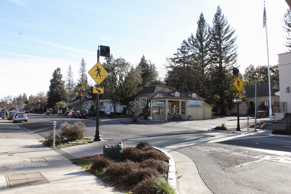
Lighted pedestrian crossing at the Sebastopol Post Office
I took on the project as a subcommittee of one and headed out with measuring wheel, camera and notepad. I worked with several criteria:
- It would benefit primarily visitors using the Rodota Trail or Ives Park — the locals will likely take the most convenient route regardless of wayfinding signs
- It should be as direct as possible
- It must be safe and accessible to all — no ADA issues and ok for both pedestrians and bikes
- It needs to on public streets and sidewalks
- It should include the crosswalks with flashing warning lights (at the end of the Rodata Trail on Petaluma Ave. and in front of the Post Office on South Main)
Finding a good route proved harder than expected. The way most pedestrians — and quite a few cyclists — take goes through a private parking lot. The route that uses the line drawn on our Bicycle & Pedestrian Master Plan includes a steep hill– not so good in a wheelchair. Using the sidewalk on South Main would be limited to pedestrians only. In the end, our recommended route takes cyclists through the City parking lot between Petaluma Ave. and South Main and pedestrians on the east side of South Main north to Burnett Ave., even though that intersection has no flashing lights and has seen a number of collisions over the past several years.
Cittaslow Sebastopol is working with Complete Streets to create a set of walking routes originating at the downtown plaza, again mostly for visitors, as part of “Park Once & Walk” initiative. They will set up a 60-day pilot this summer with publicity and temporary signage to see how well the routes would work. Since the two projects have a lot of overlap, we were able to piggyback our recommendation with their presentation before City Council and both were approved. Council directed us to coordinate with the Park Once & Walk pilot so we’ll conduct our pilot at the same time and use similar signs.


Leave a comment
Comments feed for this article